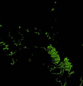
ga_ls_mangrove_cover_cyear_3_x28y44_2012-01-01_final
dataset of product ga_ls_mangrove_cover_cyear_3
Indexed by odc_writer
,
created
Region
x28y44
for
1st January 2012
Fields 🔗
cloud_cover
•
creation_time
2022-04-01 08:31:07
crs_raw
epsg:3577
dataset_maturity
final
format
GeoTIFF
id
5827d208-3415-45d9-92c4-5f5b1d55831b
instrument
ETM
label
ga_ls_mangrove_cover_cyear_3_x28y44_2012-01-01_final
lat
-11.85 to -10.96
lon
132.0 to 132.863
platform
landsat-7
product_family
mangrove_cover
region_code
x28y44
time
2012-01-01 00:00:00 to 2012-12-31 23:59:59
Related Datasets 🔗
ga_ls_mangrove_cover_cyear_3_x28y44_2012-01-01_final