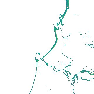
ga_s2ls_intertidal_cyear_3_x170y164_2017--P1Y_final.stac-item
dataset of product ga_s2ls_intertidal_cyear_3
Indexed by odc_admin
,
created
Region
x170y164
for
1st January 2017
Fields 🔗
creation_time
2024-03-26 08:23:47
dataset_maturity
final
eo_gsd
10.0
format
GeoTIFF
id
fe07d22f-eacb-4b12-be63-60dd3f0ae563
instrument
ETM_OLI_TIRS_MSI
intertidal_hat
1.22
intertidal_hot
0.92
intertidal_lat
-0.92
intertidal_lot
-0.76
intertidal_offset_high
14.04
intertidal_offset_low
7.63
intertidal_otr
1.68
intertidal_spread
78.33
intertidal_tr
2.14
intertidal_tr_class
mesotidal
label
•
lat
-15.314 to -15.001
lon
141.449 to 141.765
platform
landsat-7,landsat-8,sentinel-2a,sentinel-2b
product_family
intertidal
region_code
x170y164
time
2017-01-01 00:00:00 to 2017-12-31 23:59:59