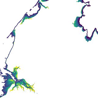
ga_s2ls_intertidal_cyear_3_x107y159_2018--P1Y_final.stac-item
dataset of product ga_s2ls_intertidal_cyear_3
Indexed by odc_admin
,
created
Region
x107y159
for
1st January 2018
Fields 🔗
creation_time
2024-04-02 08:03:00
dataset_maturity
final
eo_gsd
10.0
format
GeoTIFF
id
bd89f7e6-c1ac-464a-8094-174c6b7e66a9
instrument
ETM_OLI_TIRS_MSI
intertidal_hat
3.88
intertidal_hot
2.52
intertidal_lat
-3.96
intertidal_lot
-2.82
intertidal_offset_high
17.36
intertidal_offset_low
14.38
intertidal_otr
5.34
intertidal_spread
68.26
intertidal_tr
7.84
intertidal_tr_class
macrotidal
label
•
lat
-16.806 to -16.496
lon
122.717 to 123.036
platform
landsat-7,landsat-8,sentinel-2a,sentinel-2b
product_family
intertidal
region_code
x107y159
time
2018-01-01 00:00:00 to 2018-12-31 23:59:59